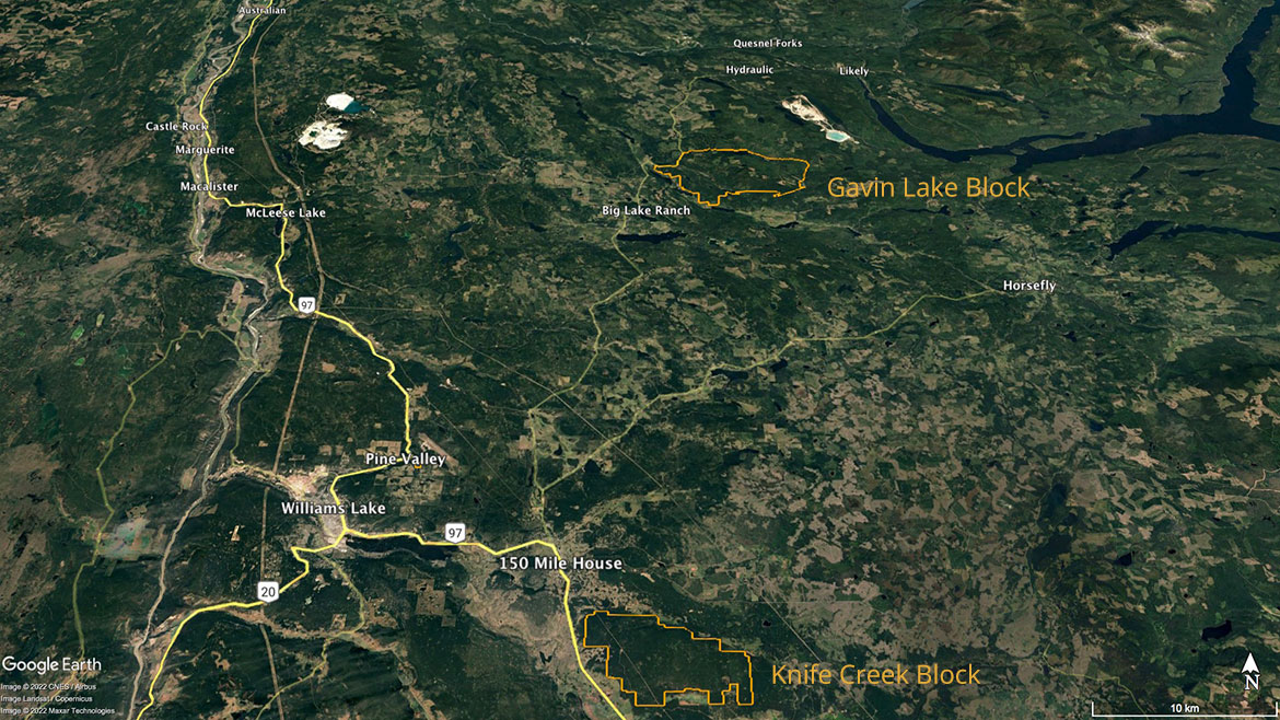
Directions to the Gavin Lake Block
UTM coordinates (NAD83) 10U 581272 5816186
Gavin Lake Block Map (11″ x 17″)
From the South
Turn east at 150 Mile House onto the Likely Road (150 Mile House is 14 km south-east of Williams Lake on Highway 97). After 4 km, turn left onto the Likely Road where it forks with the Horsefly Road and follow it for 47.7 km. The Gavin Lake Road is on the right and is marked by the Gavin Lake Forest Education Centre and UBC/Alex Fraser Research Forest signs. The Research Forest is all along the eastern side of the Likely Road from the bottom of Beaver Valley to the Gavin Lake Road (approx. 5 km).
From the North
Turn east off of Highway 97 at McLeese Lake (approx. 45 km north of Williams Lake) onto Beaver Lake Road, and continue for 3.3 km. Turn right onto the gravel portion of Beaver Lake Road. Follow this route until it meets the Likely Road (approx. 35 kms). Turn north (left) and drive for about 6 kms to the Gavin Lake Road.
Download Directions and Map for Gavin Lake Camp (pdf)
Directions to the Knife Creek Block
UTM coordinates (NAD83) 10U 575165 5767955
Knife Creek Block Map (11″ x 17″)
The main access is via the Big Meadow Road. It intersects Highway 97, 4.7 km south of the Likely Road intersection in 150 Mile House. 150 Mile House is 14 km south-east of Williams Lake on Highway 97.